Information
- Distance: 3 miles, walked by Keith Ryan and transcribed by Simon Avery
- Grade: Gentle
- A GPX route of this walk is available: Download GPX
- Directions to Car Park
- What Three Words
overlaps.pelted.revisits
Map

Introduction
This walk takes us over open moorland amongst bronze age hut circles, burial cists and other ancient remains.
Sheeps Tor

Follow the wide track East, over the stream and left of the Scout Hut, before leave it when we reach the Corn Ditch Wall
Corn Ditch Wall

A Corn Ditch Wall is an artificial barrier separating grazing land and the common moorland.
Where it differs from a normal wall is that the land approaching it from the moor side is steep and difficult to negotiate, but the earth on the other side ramps up to its top. This is to allow animals to leave the richer farm grazing and venture forth onto the moor.

Outhome Cist


Cuckoo Rock

The name is said to come from this being the place where a local farmer always heard the first cuckoo, although one can also believe that it looks like a cuckoo’s egg in a nest of small eggs.
It was once a tradition for young boys to climb this rock, which is a bit of a struggle.
Shaft

Just to the right of this and behind the wall, is a mine shaft that’s marked “Shaft” on the map.

Adit

Tip: To find this adit, cross the second stile going north from the corner of the forest. A path leads down to the left, look for running water draining from the adit. It is a few yards from the stile. Then return here and progress West
PCWW Boundary Stone

These boundary stones mark the point where rainfall will end up in the Burrator Reservoir. They encircle the whole of the catchment area and are marked PCWW for “Plymouth City Water Works”


Longstone Leat

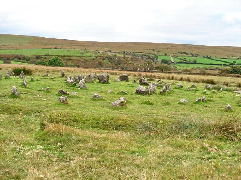
Yellowmean Multiple Stone Circle

These stone circles were rediscovered in 1921 when covering heather was burnt off during a drought, and the rings re-erected. It is possible that they were not replaced in the correct positions.
There is also some evidence for a double stone row at this point.

Note the disturbed ground from one of the trenches from the 2008 excavation completed shortly before this photo was taken.


Follow the map Southeast to return to our parking


Parking
There is usually parking at the Gutter Tor car park, shown with a yellow cross on the map
